Visa

About African Regional Institute for Geospatial Information Science and Technology
A regional geospatial institute
The African Regional Institute for Geospatial Information Science and Technology, known as AFRIGIST, is a regional educational and research institution based within the campus of Obafemi Awolowo University in Ile-Ife, Osun State, Nigeria. It was formerly called the Regional Centre for Training in Aerospace Surveys, or RECTAS. Its work centres on developing the knowledge and practical capability needed to produce, manage and apply geospatial information.
The institute was established in 1972 under the auspices of the United Nations Economic Commission for Africa. Its institutional history traces the idea for a regional cartographic centre to a United Nations conference in Nairobi in 1963 and a subsequent Economic Commission for Africa resolution in 1964. AFRIGIST describes itself as an intergovernmental institution serving Africa, with English and French as its working educational languages.
Sources: About the institute ↗
Purpose and professional training
AFRIGIST’s mission connects capacity building with the timely delivery and responsible use of geospatial information. Its objectives combine theoretical instruction with practical training in photogrammetry, remote sensing, cartography and geographic information systems. These disciplines provide different ways to observe, represent and analyse places, resources and environmental conditions.
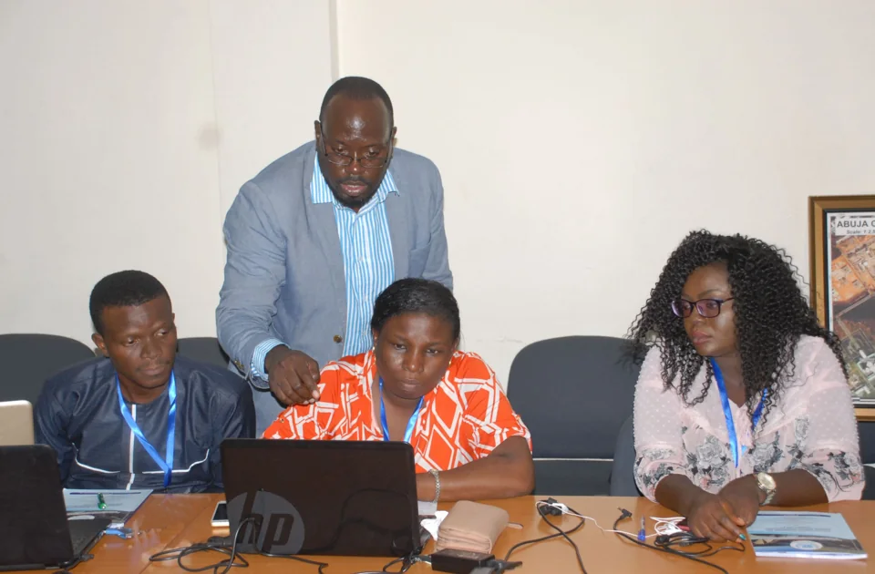
The institute’s educational remit extends beyond long academic programmes. It identifies short courses, refresher training, workshops and conferences as additional ways to develop professional capability. Its training approach includes classroom interaction, distance learning and customised blended provision. Research and advisory work form part of the same institutional purpose, connecting education with the production, management and dissemination of spatial data. The stated emphasis is on building capability relevant to member states and Africa more broadly.
Its objectives also include seminars that allow officials and practitioners to exchange information and experience. This professional exchange complements formal instruction, helping connect the technical methods taught at the institute with the responsibilities of organisations that use geographic information.
Sources: AFRIGIST mission and objectives ↗ · Institutional profile brochure ↗
Academic and professional pathways
The published programme portfolio includes a Technologist Diploma and a Postgraduate Diploma in geospatial information production and management. Specialisations include remote sensing, photogrammetry, cartography and geographic information systems. The institute also lists a Professional Master in the same broad field, explicitly described as in-service professional training.
Further study is provided through both institute programmes and university collaborations. The course directory identifies master’s study associated with the University of Abomey-Calavi, the Federal University of Technology Akure and Obafemi Awolowo University. These arrangements include geo-information science, geo-information technology and geospatial information production and management. The language of instruction differs between pathways, with some offered in French, some in English and others described as bilingual. This range reflects the institute’s regional purpose and its use of university partnerships to extend advanced geospatial education.
Sources: Courses and programmes ↗
Admissions and academic preparation
The institute’s published 2025–2026 admissions guidelines illustrate the different entry routes associated with its programmes. Technologist-level entry is linked to prior technical qualifications, while postgraduate pathways draw applicants from degree or higher-diploma backgrounds. The documented subject backgrounds include science, engineering and other disciplines where geospatial methods can be applied.
The guidelines distinguish in-service professional training from other advanced academic pathways. They also provide application forms in English and French, consistent with the institute’s bilingual role. Applications can be completed and submitted through the institute, with supporting qualifications considered in relation to the selected programme. The document presents a structured progression from technical education to advanced professional and research-oriented study, rather than a single course intended for every applicant.
Sources: 2025–2026 admissions guidelines ↗
Research and applied enquiry
AFRIGIST’s research agenda includes environmental and disaster management, geospatial data infrastructure, land administration, electronic governance, land-use change and climate change. Its published research record provides examples of how spatial methods have been applied to specific development questions.
Historical projects include research on indigenous knowledge and adaptation to coastal flooding in Nigeria, supported during 2011–2013. A 2013 project compared land-use patterns in the Sudano-Guinean transition zone in Benin and central-western Nigeria. Another project, dated 2014, examined climate change and climate-resilient agriculture in coastal Nigeria. These are documented as completed studies. Together they show an established interest in environmental change, local responses and the use of geographic evidence across national and ecological settings.
Sources: Research activities ↗
Workshops, consultancy and knowledge exchange
The institute’s record of conferences and workshops shows the development of professional geospatial training over time. Listed subjects include desktop cartography in 1998, digital photogrammetry in 2001 and regional geospatial data infrastructure in 2005. Later activities addressed lidar and radar technology, African geodetic reference work, and global spatial data infrastructure.
A 2012 activity focused on space-based technology for disaster management, while a 2015 refresher course examined pro-poor and gender-equitable innovation in West Africa. These dated examples demonstrate the variety of topics covered through regional knowledge exchange.
The institutional profile also describes consultancy through RECTAS Consult. Its stated areas include map production, geographic information systems, digital image processing, spatial analysis and web mapping. Such services connect the institute’s teaching and research with practical information needs in public and private organisations.
The profile identifies additional applications in land administration, disaster management, geology, health and epidemiology. Its account of short training includes digital cartographic production and the management of continuously operating reference stations. These examples illustrate the breadth of uses associated with geospatial skills.
Sources: Conferences and workshops ↗ · Institutional profile brochure ↗